ABSTRACT
A multiscale experimental approach, consisting of full-scale measurements and physical modeling in a laboratory environment, was conducted to investigate the flow field over a coastal escarpment on the Wind Energy Institute of Canada’s research and development wind park. The influence of sea breeze inflow conditions, thermal stability and local topographic features on the flow field were examined.
The results of the full-scale study show that the near surface flow field is significantly influenced by the sea breeze circulatory coastal flow regime, creating larger shear layers with a smaller recirculation regions compared to cases of typical boundary layer flow.
Results of the physical modeling show an agreeable comparison between the hub height wind speeds at the location of a turbine was achieved under non-ABL conditions by simulating the non-ABL inflow. Additionally, significantly different mean and turbulent flow fields were observed for three different escarpment geometries.
FIELD INVESTIGATION OF INFLOW AND ATMOSPHERIC STABILITY EFFECTS ON FLOW OVER AN ESCARPMENT
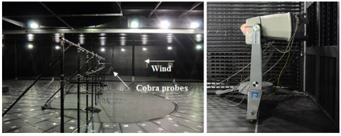
Figure 2-3: Cobra Probe array at the center of the chamber (X = 12.5) (left). Orientation of the windscanner in front of the first column of fans (right).
A horizontal rake of 11 Cobra Probes, which are four-holed pressure probes capable of measuring the three components of velocity, was placed across the chamber with each probe positioned at the center of the inner 11 columns of fans. Each Cobra Probe in the horizontal rake was positioned 1.3 m from the floor, aligning them with the scanning head of the windscanner in its 90˚ position as shown on the right in Figure 2-3.
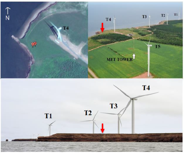
Figure 2-5: Research and Development park, PEI (top right) with windscanner locations (top left) and the escarpment from an upstream point of view (bottom). Red arrows are the location of the windscanner.
During the experiment, WEICan provided 10-minute mean wind speed, wind direction, atmospheric pressure, and temperature data acquired from the IEC compliant 80 m mast located about 500 m from the coastline shown in Figure 2-5. Additionally, turbine 4 provided 10-minute mean data of wind speed, nacelle position and active power.
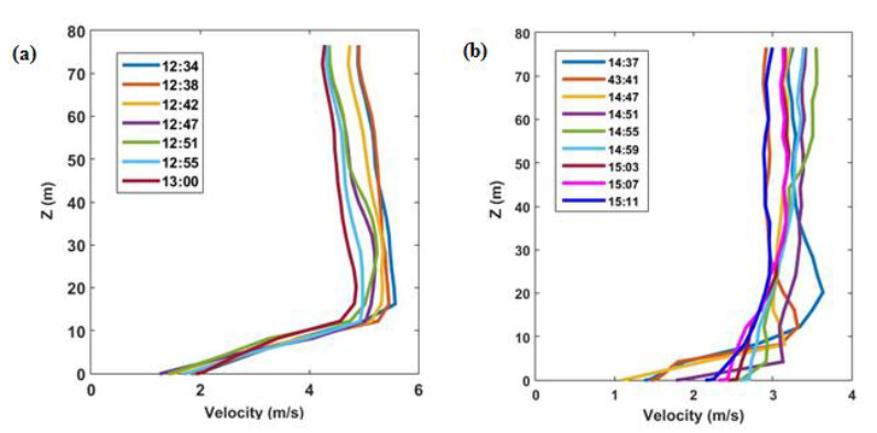
Figure 2-14: Velocity profiles of individual scanned cycles (30 seconds) during the measurement period with neutral stability (a) and stable (b) conditions.
The increase in the fluctuations by approximately 80% during this 10-minute interval, is closely related to the gust observed in the sea breeze profile under neutral conditions presented in Figure 2-14a. During this 10- minute period, the mean wind speed at 80 m was 4.37 m/s while the wind speed at 40 m was 5.27 m/s giving a cubed ratio equal to 0.74.
EXPERIMENTAL INVESTIGATION OF IMPACT OF INFLOW CONDITIONS AND LOCAL TOPOGRAPHIC FEATURES ON A COASTAL ESCARPMENT
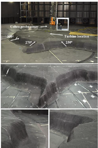
Figure 3-1: Scaled model of a section of the Research and Development Park, P.E.I.
Figure 3-1: Scaled model of a section of the Research and Development Park, P.E.I. Shown are the three wind directions investigated with the rake of Cobra Probes at the turbine location (top), an above view of the escarpment geometries (middle) and views of the escarpment sections from 230° (bottom right) and 300° (bottom left)
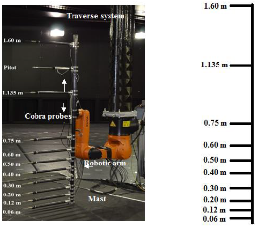
Figure 3-2: Cobra Probe rake (left) and depiction of the heights of Cobra Probes (right).
A schematic of the rake can be seen in Figure 3-2. The total vertical distance covered by probes was from 0.06 m (3 m full-scale) to 1.6 m (80 m in full-scale), measured from the surface of the model. The top probe in the arrangement was positioned at the hub height of the turbine at the field site, while three probes were located within the lower radius of the turbine (33.5 m full-scale).
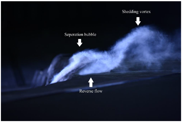
Figure 3-8: Flow visualization downstream of the escarpment for WD230.
Flow visualization was also conducted for the case of WD230, shown in Figure 3-8, which revealed features of the flow which were not able to be captured by the Cobra Probes. Three distinct features can be seen near the surface downstream of the escarpment. The shear layer and separation bubble can be seen with a small region of reverse flow near Z = 3 m. Additionally, a secondary vortex can be seen leaving the separation bubble and travelling downstream.
CONCLUSIONS AND FUTURE WORK
The emergence of wind energy has led to an increased number of wind turbines placed in complex terrain, where predictive models struggle to accurately predict the wind conditions. This study was conducted to investigate the influence of inflow conditions as well as local geometry on the flow over complex terrain. To achieve these goals a full-scale field campaign and scaled physical testing in a laboratory setting were conducted.
Full-scale measurements were undertaken at the Wind Energy Institute of Canada research and development park in Prince Edward Island, Canada. A scanning lidar was deployed to measure the open-water fetch inflow over a steep, sharp-edged escarpment up to the height of a local wind turbine and the near surface flow field up to a height of 20 m.
The wind speed measurements were analyzed and the results were presented in the form of velocity and turbulence intensity profiles as well as wake characteristics downstream of the leading edge of the escarpment. A full-scale sea breeze circulatory coastal system was identified in the first half of the measurement period under neutral and stable atmospheric conditions, having large velocity gradients in the lowest heights near the surface with negative shear above a local maximum. In the second half of the measurement period, the inflow was a typical boundary layer was identified under both stable and unstable atmospheric conditions.
Source: Western University
Authors: Julien LoTufo